If you happen to be in the Phoenix area and have a hankering for gorgeous views and mountain lakes, a drive on the Apache Trail is the thing to do. A former stagecoach route through the Superstition Mountains, this winding route travels through 40 miles of rugged mountain terrain, past a chain of deep blue lakes and alongside steep-sided canyon walls and magnificent rocky outcroppings. We drove the entire loop pictured below, starting and ending at Lost Dutchman S.P. If you set out to drive this loop give yourself a full day. We spent about 6 1/2 hours exploring the approximately 135 mile loop with many stops along the way to take in the sights and enjoy the lakes.
The Apache Trail (photo credit desertliving.com)
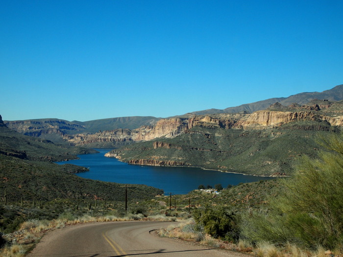
Our first stop was at Canyon Lake. This is one of the four lakes created in 1925 by the damming of the Salt River. It’s a beautiful lake bordered on the south side by deep canyon walls that plunge straight down into the water below.
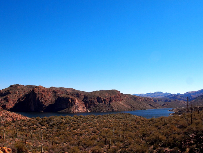
Approaching Canyon Lake
Canyon Lake has several marinas, one RV park, and a really nice public picnic area complete with covered tables and a small sandy beach area. On this kind of chilly February day we were the only beach visitors, but I imagine on a hot summer day the lake is probably crawling with folks looking to escape the city heat. Phineas was beyond excited to see the lake and wasted no time jumping in and splashing around in the frigid water.
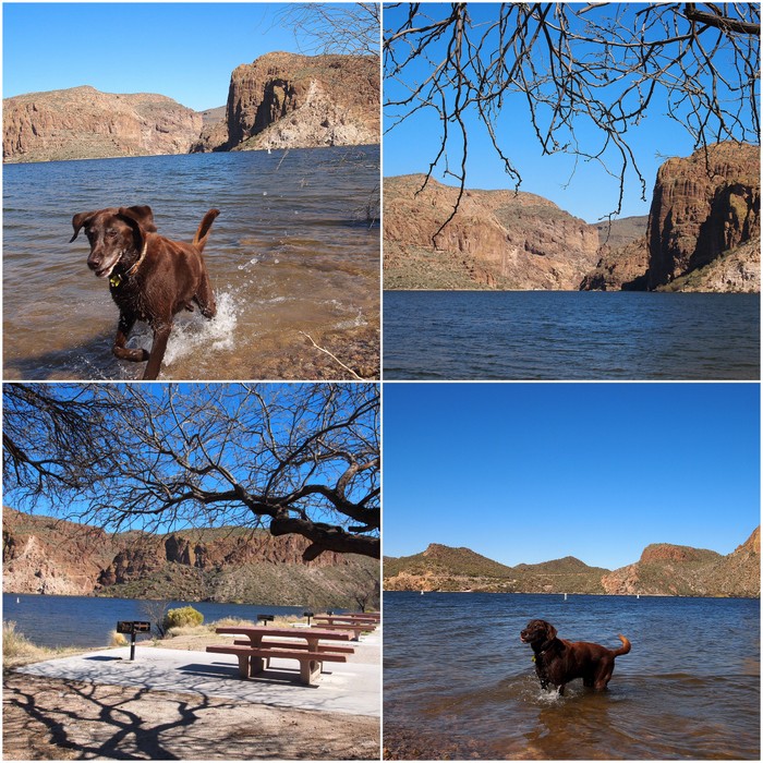
Enjoying the lake
Our next stop was a short distance away at the tiny town of Tortilla Flat. With only 6 permanent residents the entire town consists of a single building-lined street. Tortilla Flat began as a stagecoach stop for freight haulers back in 1904 during the construction of the Roosevelt Dam. After the completion of the dam it transformed into a tourist destination and continues to be a popular stop for travelers of the Apache Trail today.
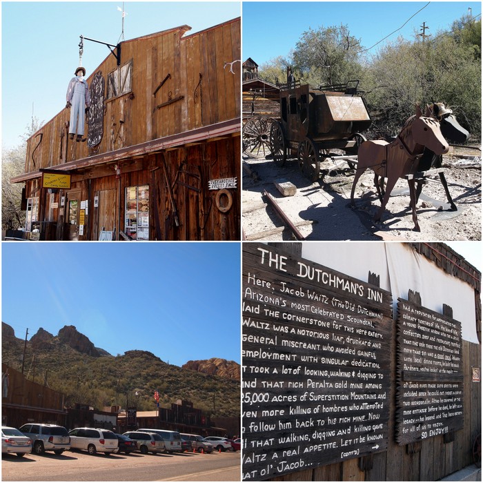
The town of Tortilla Flat
The one restaurant in town, The Superstition Saloon, was filled to capacity when we stopped around noon. We didn’t eat there because we had brought along a picnic lunch, but we went in and looked around anyway. The entire building is plastered with dollar bills signed by visitors from all around the world. Rumor has it that there is over $150,000 worth of bills on these walls!
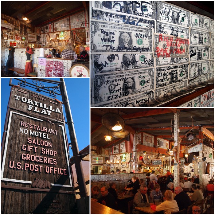
The Superstition Saloon
Not to be outdone by the monetary wallpaper in the saloon, the ladies bathroom boasts a very unique mural.
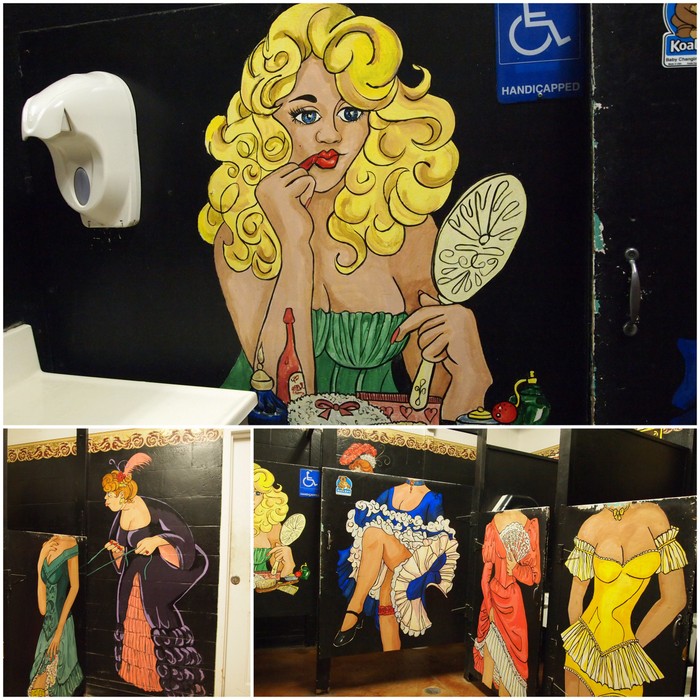
Fine art in the ladies room
After leaving Tortilla Flat the pavement disappeared and quickly transitioned from a wide (yet bumpy) dirt road to a narrow, twisting dirt track with sharp turns and plunging drop offs. You’ll notice by these pictures that there was almost always a car in front of us. We were surprised by the popularity of this road even in the middle of the week. Yet we noticed that all the way from Lost Dutchman to Roosevelt Lake everyone was going in the same direction. Only a single car passed us headed in the other direction. Strange.
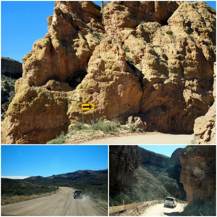
A twisty turny kind of dirt road
The road traveled along a series of switchbacks up high mountain plateaus and down into deep canyons. Along the way we were treated to spectacular mountain vistas and views of interesting geologic formations.
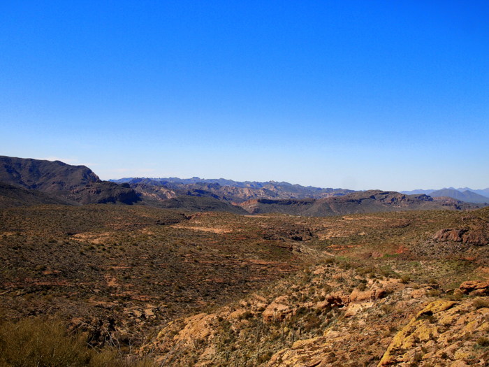
The Superstition Mountains
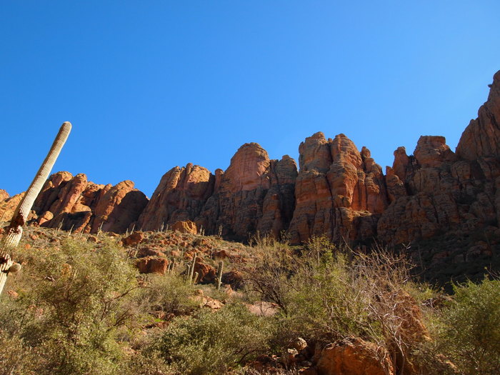
Looking up at the cool rocks
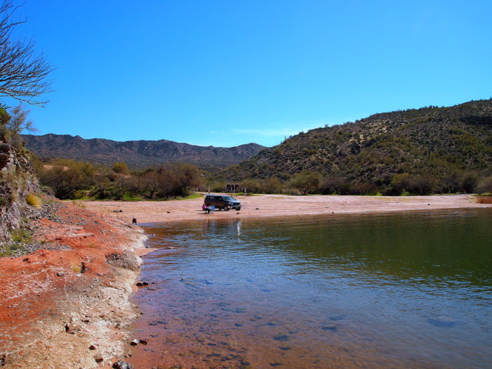
The second lake we came upon was Apache Lake. This is another lake formed by the Salt River dam and much like Canyon Lake it consists of a few marinas, an RV park and a picnic area.
The road down to Apache Lake
We found ourselves a nice secluded lakeside spot for some lunch. The picnic area was on the other side of the marina, so we pulled our chairs and small folding table out of the back of the truck to create our own picnic area.
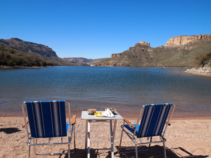
Lakeside lunch
While we ate Phineas entertained himself in the lake. This time he ventured all the way in and swam around until he was shivering from the cold water. We hung out at Apache Lake for awhile soaking up the sun and enjoying the view.
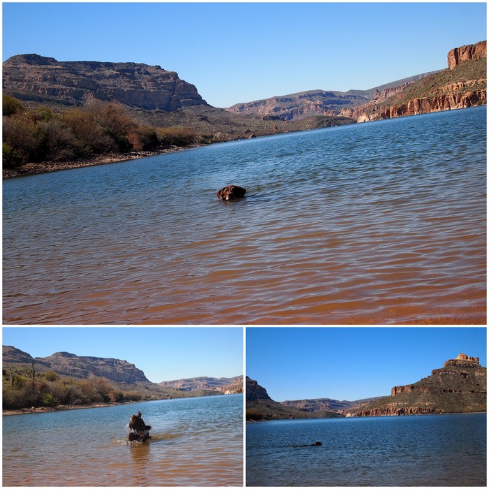
Happy swimming dog
Our very own beach
After leaving Apache Lake we traveled on towards Roosevelt Lake. A few miles before reaching the lake the road widens and turns back to pavement. Roosevelt Lake is easily accessible from the east and as a result has a more mainstream feel than either Canyon or Apache. The largest lake entirely within the state of Arizona, Roosevelt Lake is a year-round haven for boaters, vacationers, and permanent residents alike.
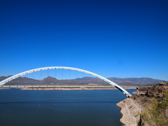
Roosevelt Lake Bridge
We stopped at the Roosevelt Lake visitor’s center to take some pictures, but didn’t actually go down to the lake. Since it was already late afternoon and we still had an hour and half drive ahead of us to get back to Lost Dutchman we decided to keep moving along the road.
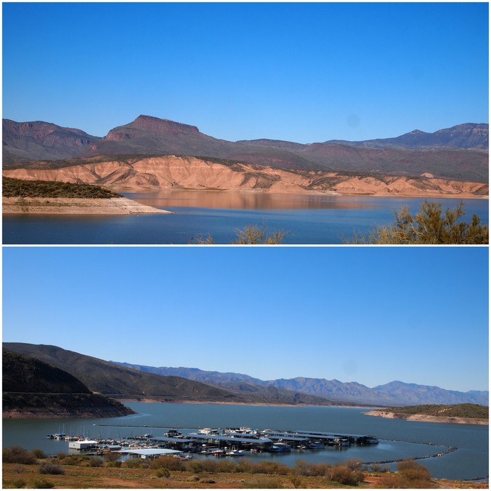
Roosevelt Lake
Roosevelt Lake marks the official end of the Apache trail. From there we traveled to the town of Globe and then followed route 60 to Apache Junction and finally back to Lost Dutchman S.P. It was a thoroughly enjoyable journey that we would recommend to anyone looking to spend some time among the mountains.
6 comments
I’m glad you enjoyed this trip as much as we did. Looks like Phin had a blast. Great write up and photos – Ingrid
So glad you guys told us about this drive! Not sure we would have done the whole thing if you hadn’t suggested it. Made for an amazing day trip.
Looks like you enjoyed the Apache Trail as much as we did. We have spent a lot of time kayaking on Canyon Lake and waterskiing on Apache. Great part of the country, especially this time of the year.
I bet kayaking on theses lakes is wonderful! Arizona continues to surprise us with its wonderful natural diversity. So glad we chose to spend the winter months here!
What a fantastic trip! I was planning for us to do this area before we changed plans. So glad you included so many beautiful pictures.
If you ever come back this way I would definitely suggest taking the drive. I missed out on a lot of photo opportunities during the most impressive part of the road because of a lack of safe places to pull over. The views down into the canyons were simply incredible!