Almost exactly three years ago we rolled in the small town of Moab in search of arches, hikes and jaw dropping views. Over the course of nearly a month we found all that and so much more.
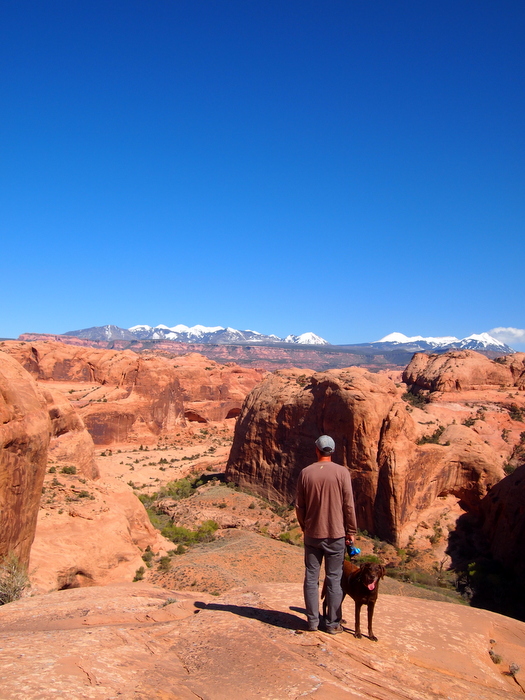
Enjoying some classic Moab scenery during our first visit in 2013
This time around we have three weeks to spend in Moab before we need to think about heading north and east. As of today, we’re only about half way through our stay and we’ve already managed to do a little bit of everything.
There’s been hiking, biking and a thrilling scenic drive. There was a week parked at a noisy, dusty boondocking spot, and then half a week (so far) at a much more private, more scenic, and less dusty boondocking site. There has been several trips to the excellent local grocery store, packages picked up, laundry done, and a delicious lunch at the brewery in town. There was a nice stretch days of warm, sunny weather, and then a not so nice stretch of fierce wind, cold and rain. There was family who came to visit us (and are still here!), new friends who joined us on our “almost-secret” boondocking road, and hope for future meet-ups with other RVers who are in town.
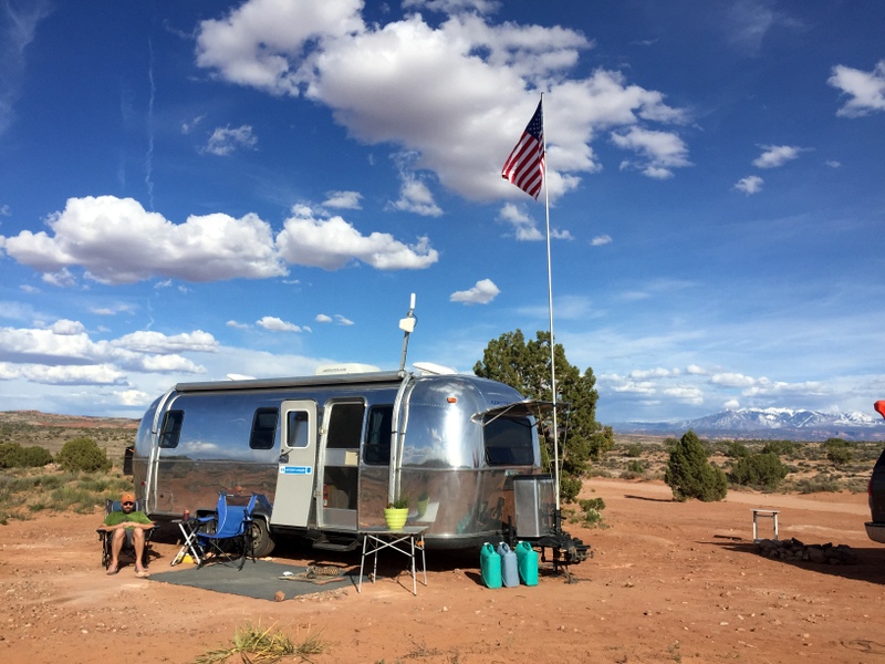
Our first boondocking spot. You can see the dusty road right behind us. Lots and lots of ATV traffic.
The one thing we haven’t done yet is venture into the main attraction that draws most people to the area — Arches National Park. We’re not purposely avoiding it (well maybe a little…it is free week at the national parks after all), but since we did most of the hikes in the park last time, we decide to hit up some new-to-us trails this time around. Starting with a spectacular hike into a hidden valley.
Hidden Valley Trail
If you only have time to do one hike outside of the national park and want to challenge yourself with a steep grade and some rock scrambling that is rewarded by amazing views and really cool petroglyphs, the Hidden Valley trail is the one to choose. This is one of those trails that starts off strong — really strong. As in you get out of the car and immediately start climbing up a steep section of tight switchbacks filled with large boulders.
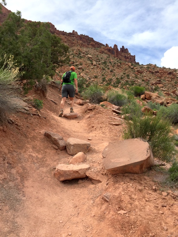
Going up…
Thankfully this section is less than a mile, and once you power through the pain you’ll be rewarded with a long stretch of flat valley bordered by impressive rock cliffs.
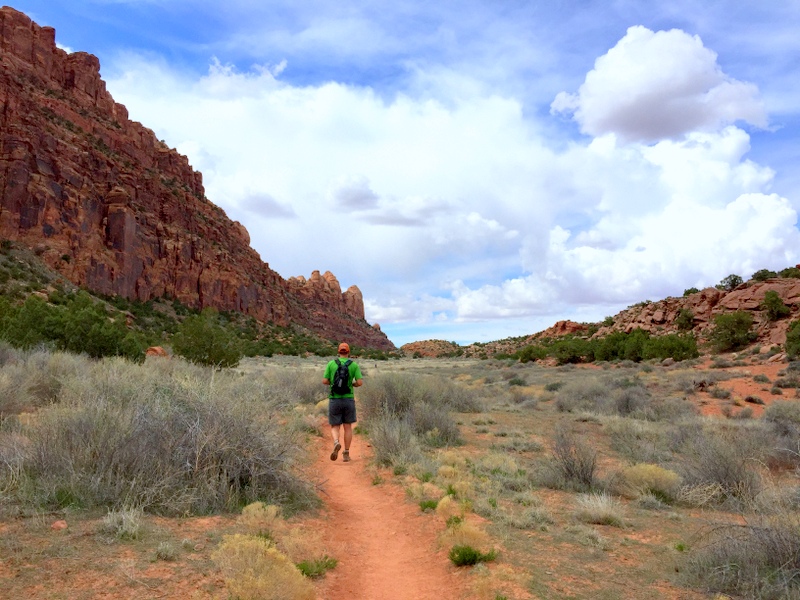
Looks like we found the hidden valley
At around the two mile point the trail climbs up to a rocky pass. If you turn around here you’ll have a completed a nice 4-mile hike. But you’ll also miss the best part. Instead, follow the trail up the pass and stay right at the fork. Soon you’ll be following a trail alongside a tall cliff. Don’t forget to stop and look back from where you came. What a view!
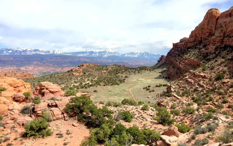
Looking back
As you climb over the pass notice the massive sandstone fins that dominate the landscape. These are part of the 12,000 acre Behind-the-Rocks Wilderness study area.
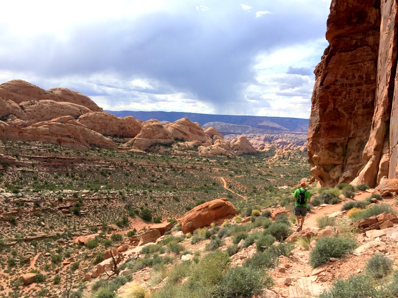
Behind-the-rocks Wilderness area
About halfway down the path we started to see panels of petroglyphs — lots and lots of petroglyphs.
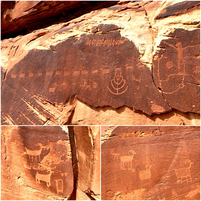
So many sheep

A person inside a person, a very large sheep, a bear print, and a long-necked antelope?
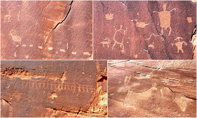
That sheep in the upper left appears to be leaving droppings behind. Also, note the high drama chase scene on the bottom right and the extra long line of people. I read somewhere that people holding hands symbolized dancing.
See why I said you didn’t want to turn around at the pass? This wasn’t even all the petroglyphs that we saw — just the ones I was able to photograph. After viewing the ancient rock art you can turn around and go back the way you came or continue to follow the trail down to the valley floor and then hook back up with the main path that will take you up and over the pass. Or… you could scoot around the cliff to the right and blaze your own path up through the pass. Guess which one we picked?
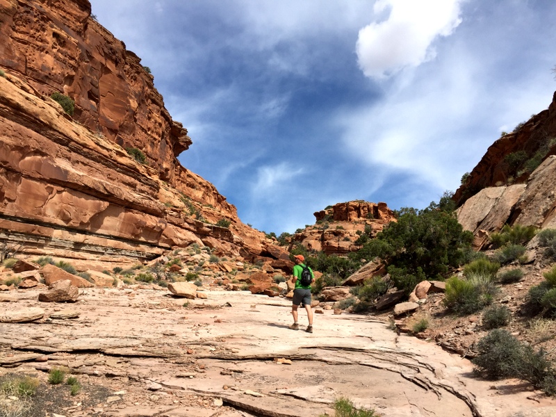
Oh, we’re just going to blaze a trail up to the top of that cliff in the middle. No big deal.
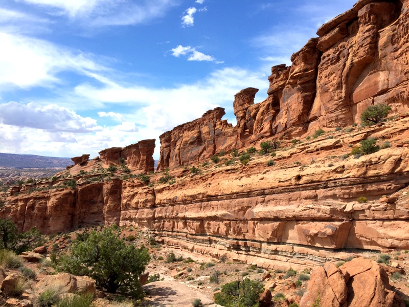
It took some scrambling, a bit of bravery, and one quick u-turn, but we made it to the top where we joined back up with the trail.
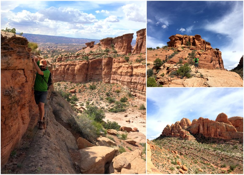
We don’t need no stinkin’ trail!
Rocks
The rest of the hike was an easy stroll across the valley and back down the steep, rocky section.
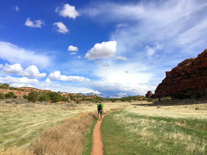
Back across the hidden valley
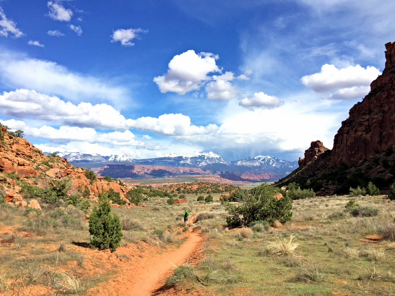
Is this real life?
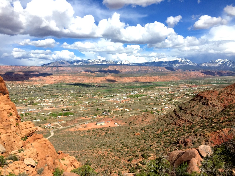
The town below
I later learned that if we had gone left instead of right at the bottom of the cliff we could have seen some ancient ruins and more petroglyphs. Whoops, I guess that’s a good excuse to do that hike again. If you want clear directions and GPS waypoints for both the hike, the petroglyphs and the ruins, check out this post from Road Trip Ryan.com.
Shafer Canyon Road to Canyonlands
After my mom and step-dad arrived late last week we wanted to take them on a grand adventure over the weekend — except the weather was not cooperating with our plans. High winds, cold temperatures, and lots of clouds kept us inside for a few days. Finally on Sunday we decided a long scenic drive was just the kind of adventure we needed. Shafer Canyon Road here we come.
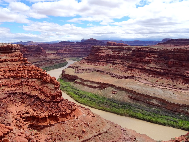
The Colorado River snakes alongside the road
We took this drive last time, and I swear Tim has been talking about it ever since. With so many crazy 4WD Jeep trails around here, it’s nice to find a 4WD road that we could easily drive with our big truck. In fact, any high clearance vehicle could drive this road.
I didn’t take many pictures of the beginning of the road because I was sitting in the back seat. It’s pretty spectacular though. Lots of red cliffs, spires, and balancing rocks. We stopped at the pull-off near where the famous scene at the end of Thelma and Louise was filmed.
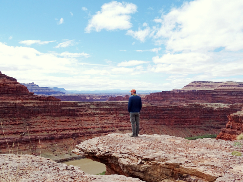
Tim standing near where Thelma and Louise went over the edge
All this is great, but the very best part of Shafer Canyon Rd. is last part. For 6 miles the road climbs up a sheer cliff on a series of steep switchbacks. It’s one of those roads that you can’t believe was ever built. As expected, the view was incredible.
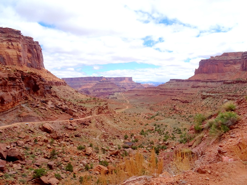
At the start of the switchbacks looking back at the road we just drove.
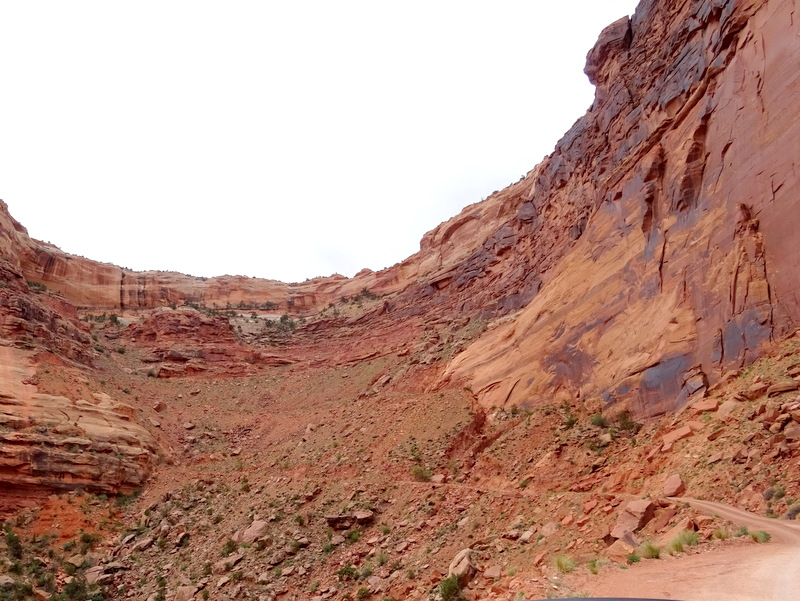
Yes, the road really does go up there.
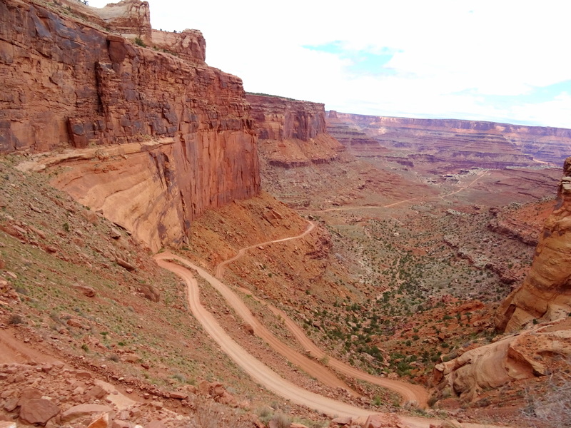
Looking down on the switchbacks
Obviously, this is not a road for those with a fear of heights. For the rest of us who enjoy a good thrill, this road is a must drive though. Just look at that view!
For a taste of what it’s like to drive up Shafer Canyon check out this sped up version of our dash cam video. Because the dash cam is mounted in a fixed location it only shows the road in front of us, but gives you a pretty good idea of the twists and turns and sharp drop offs.
At the top of the cliff we entered the Island in the Sky section of Canyonlands National Park. The wind was whipping and the temperature at the top a brisk 45 degrees, but we braved a super quick picnic, and then drove over the Grandview overlook where we gazed over the edge.
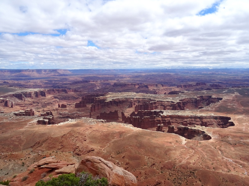
View from the Island in the Sky
Someday we’ll come up here when it’s not cloudy This is exactly what the sky looked like three years ago when we visited Canyonlands. In the interest of stretching our legs and getting some much needed exercise after several days inside we followed the one-mile path along the canyon rim.
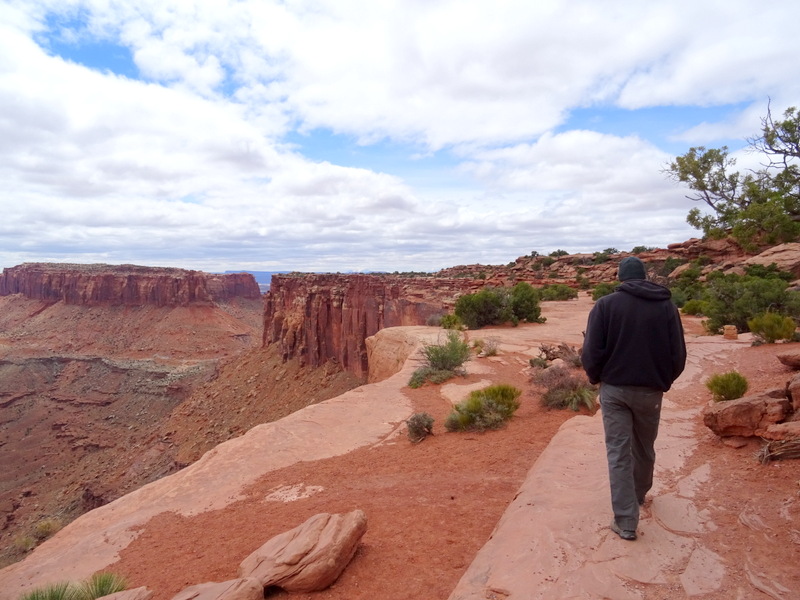
Tim bundled up like it’s winter
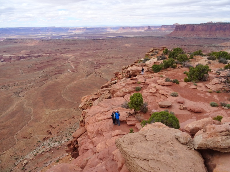
Found some friendly people below :)
Once again, just like last time we didn’t do any more hikes around the park. Maybe some day we’ll come up here via the main road and actually have time to do more exploring. It’s still an amazing place even if you only see the main Grandview point overlook.
Aside from these two great adventures, our main activity in Moab has been mountain biking. Despite my initial hesitation (I’m a very beginner kind of mountain biker), we found some trails that seemed like they matched my skill level, and much to my surprise I’ve really been enjoying myself. So much so, that I want to write an entire post about mountain biking for beginners in Moab. But we still have lots more biking to do, so that will have to wait another few weeks. Until then, here’s a shot of our current boondocking spot. More details on that next time…
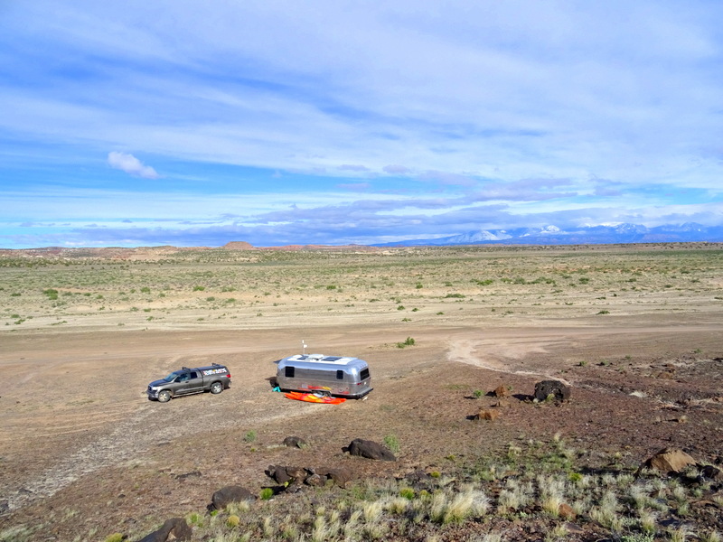
Our neighborhood

16 comments
We LOVED Hidden Valley too! We looked a bit for the ruins we’d heard about but did not find them. I so want to go back and do some hiking among all those fins and, of course, search again for the ruins.
Yep, easy mountain biking IS possible in Moab. Glad you found some good rides too…
I think Hidden Valley is now on the list of “favorite hikes”! We would also like to go back and do more exploring among those amazing rock fins. It was partially thanks to your blog that we found some great bike trails. Your write up in the trails at Dead Horse convinced me that I could handle it up there. Thanks for sharing :)
So you’ve been biking at Dead Horse? We’ve never been there, but will be coming to Moab in about a month (sounds like we’ll just miss you!!). Just curious if you like it….
We loved it! In fact, we hope to go back one more time before we leave. The trails are great for a beginner rider like me with some rocks and obstacles, but nothing too technical. And the views can’t be beat!
Hidden Valley looks amazing! Definitely putting that on our list. We’ve had a lot of fun on relatively easy mountain biking trails in Moab, too — it’s a blast biking on slick rock! Gorgeous colorful photos, as always.
Yup, Hidden Valley is one of those “must hike” trails. This spring is my first experience biking on slick rock, and I’m amazed how fun it is!
Your pics are stunning, your blog is engaging, and the dash cam is AWESOME!!! We loved spending time in Moab and are dying to go back. Your blog reminded us why. Love the details and hope you keep up the sharing! Can’t wait to read more!
Thanks Melissa! Moab is such a special place. I feel like we could come back here again and again and never experience it all.
Whoa! The vid was an extra special treat! And in fast motion, to boot! Felt like the Best Ever roller coaster ride! Thanks for sharing such a great post. :-)
Every time I watch the video I want to yell “slow down” :)
SO awesome! We would love a boondocking spot like that. The more desolate the better…at least when we’re in that mood. Meanwhile thanks for the video. Got my heart pumping! And as always the photography is stunning.
This spot is the perfect mix of desolate + close to down. For us that’t the ideal situation. Glad you enjoyed the video!
Clearly very few of us are NOT in Moab this month! Love the Hidden Valley hike, especially the “real life” pic :-) I was pretty sure I was never going to drive Shafer, but now that I’ve “ridden” it I know I never, ever have to do it again – whew! Beautiful neighborhood, hope the ATVs respect your air :-)
It does seem to be a popular place for full-timers to gather. I think because the weather is so great here in April (aside from the wind). Glad we could take you along on our ride up Shafer Canyon ;)
Great post. We love Moab and want to go back and spend more time. Check out the Moab Brand Trails if you haven’t already. Some pretty easy rides and awesome views in Arches NP – http://www.utahmountainbiking.com/trails/brand-trails.htm
We loved those trails. Rode over there twice in fact. As you say, some easy rides and those vies can’t be beat!