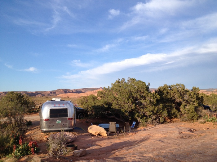
Our last week in Moab was a bit less exciting than our first two. This tends to happen when we spend an extended amount of time in one place. The first week or so we cram in as much as possible, trying to see and experience all the area has to offer. Than we slow it down and spend more time chilling at home, or sometimes re-visiting a few of our favorite spots. Sand Flats Campground was a perfect spot to spend our slow week. While we (by we I mean Phineas) missed having the grand Colorado River as our neighbor like we did at Goose Island, we loved the privacy that our site at Sand Flats offered. One side was shielded by trees, another was very far from any other sites, and the back of our site was nothing but a wide expanse of sandstone.
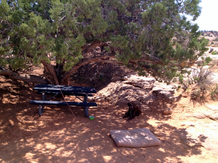
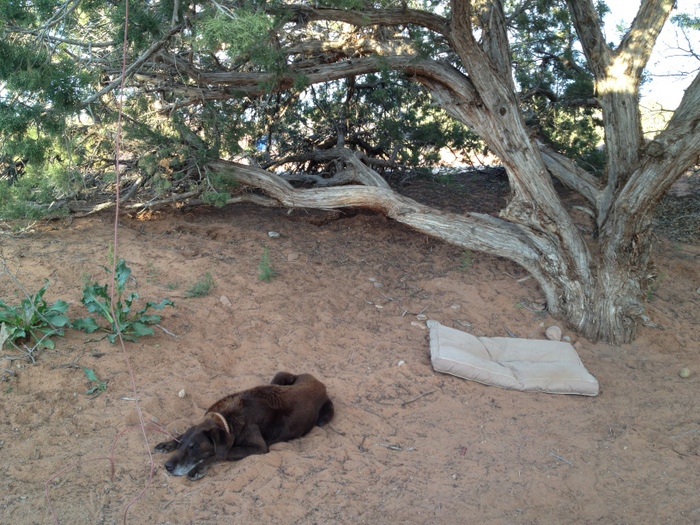
Our water dog may have missed his river-front site, but I think this large Pinyon Pine (pretty sure that’s what kind it was) more than made up for it. This dog does not like heat. We’ve noticed that as he gets older he is less and less tolerant of any temperature over seventy degrees. He pants and paces and is generally unhappy with life. We try our best to keep him as cool as possible, but not every camp site can be a water-front site. Luckily, he seems to accept a cool shady spot as a second best alternative. The branches of our Pine tree hung low, creating a kind of shady, sand-filled oasis for him to enjoy. He spent many, many hours lounging under this tree, often preferring a freshly dug sandy hole to his dog bed.
Things warmed up considerably this week in Moab. Funny to think that during our first week in town it was chilly and rainy. So chilly that we even spent one whole day inside with the heat on. Not anymore. This week it was in the mid-80s with bright sunshine blazing down and filling our batteries by noon everyday. Phineas is not the only one who likes to cool off by the water when it gets hot, and lucky for us the Mill Creek was only a five minute drive from the campground. Mill Creek is a popular swimming area on warm days in Moab. There’s a sandy trail the goes up the canyon alongside the river. Some areas of the river are deep enough for dogs to swim, and some are deep enough for people to swim. There is one very popular waterfall spot where brave (or dumb?) soles jump off into the rather shallow water below.
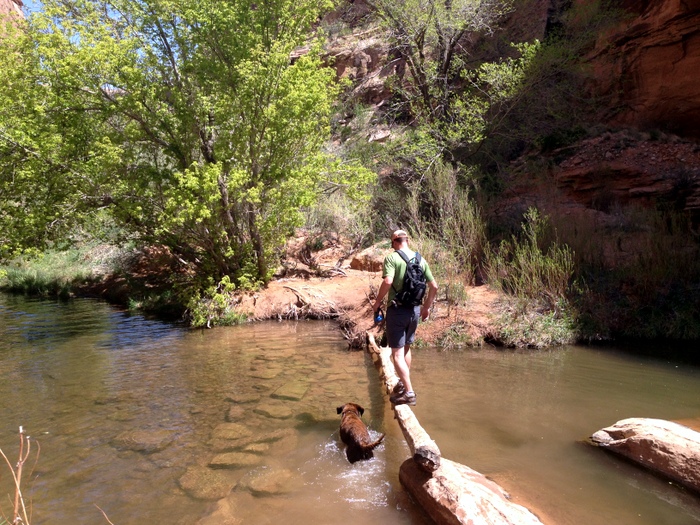
The trail crosses the stream a few times and you can choose to either wade through or cross by rock hopping and occasionally scaling a log bridge. Tim managed to stay dry the entire hike, but after successfully navigating the most difficult crossing, I failed at the next one and had to get my feet wet. The cool stream actually felt good on the legs, but back on the trail my shoes were soon covered with red sand that will probably never completely wash out.
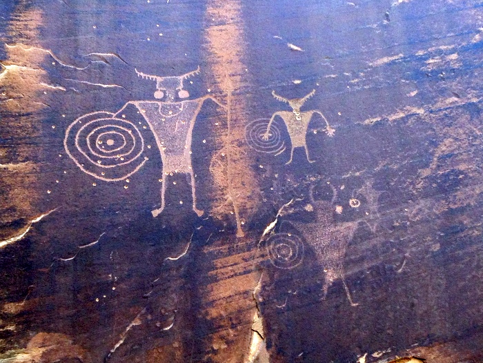
We continued on the trail for about two miles up the canyon until we could go no farther. Along the way we made a detour to find a Geocache and spotted these very cool petroglyphs on the canyon walls. We liked Mill Creek so much that we returned again later in the week.
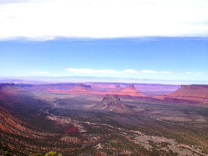
Earlier in the week when the weather was still on the chilly side, we took a drive up Sand Flats Rd and through a portion of the Manti-La Sal National Forest. Once we crossed into the national forest we spotted a few dispersed camping sites. One was definitely a tent only kind of spot where no RV would want to drive. There was a sign marked Castle Valley overlook so we parked the truck and walked up to see the view. What a view it was!
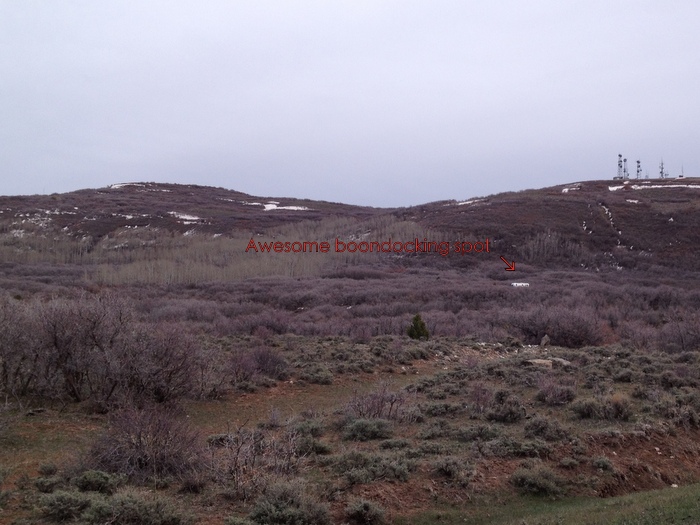
At the end of Sand Flats Rd. we turned onto the Mountain Loop Rd that travels below the majestic La Sal mountains. We were still in national forest land and spotted a few more nice dispersed camping sites. We even saw an airstream parked way out in the middle of nowhere off the side of skinny dirt forest road. The best thing about this spot was that even though it was at least twenty minutes from town, and very secluded, it got full bars of 4G cell service. See those antennas on the hill above the airstream? That’s right those are cell towers. Nature + internet = happy campers in our opinion. The biggest downfall to this awesome spot was the cold. We had driven up quite a bit in elevation, and while the temperature back at our site was almost 70, the temperature here was only in the 40s! Guess this in one of those spots you seek out only in the hotter summer months.
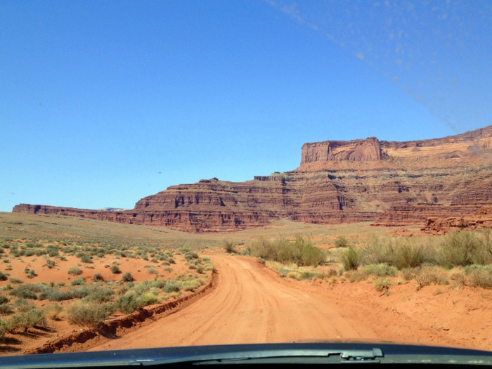
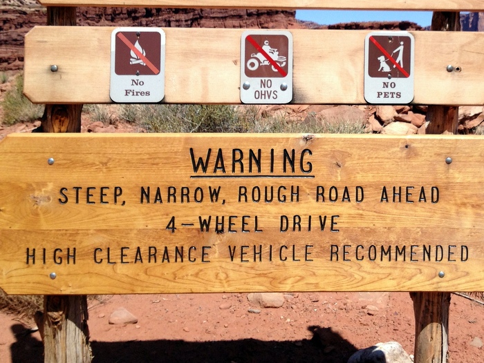
By far our most exciting excursion of the week was trip to the Island in the Sky section of Canyonlands National Park. We actually made this trip over a week ago, and while I had the best intentions of devoting an entire blog post to the visit- somehow it never happened. So I’ll do my best to summarize it here for you. To reach Islands in the sky from Moab you can take a short, pleasant 30 minute drive on a regular paved road. Or you can make the hour+ 4-wheel drive adventure over rutted roads and up a steep canyon wall. Which route do you think we choose? The 4-wheel drive road of course! Tim never misses an opportunity for a little rough road adventure in the big truck. Although, I like to remind him that we pull our house with this truck so don’t go too crazy. Shafer Canyon Rd starts of innocently enough with a rather tame drive on a dirt road past some cool rocks and other typical Utah scenery.
Then we got to the fun part.
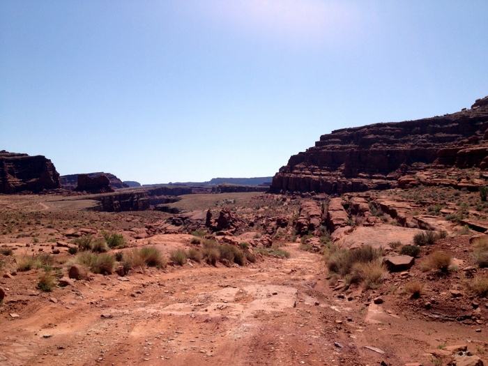
The road became rough and rocky, with a few spots where we had to climb over large rocks and dip down into deep ruts. I didn’t get any photos of the most treacherous parts of the road because I was too busy hanging on to wield the camera.
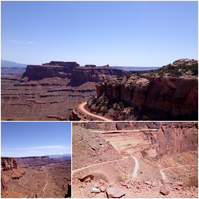
The final part of the Shafer Rd. is a series of long switchbacks that climb up the canyon. It was a pretty stunning drive and when we stopped at the top we could see the twists and turns below and the long dirt road that we had traveled through the canyon.
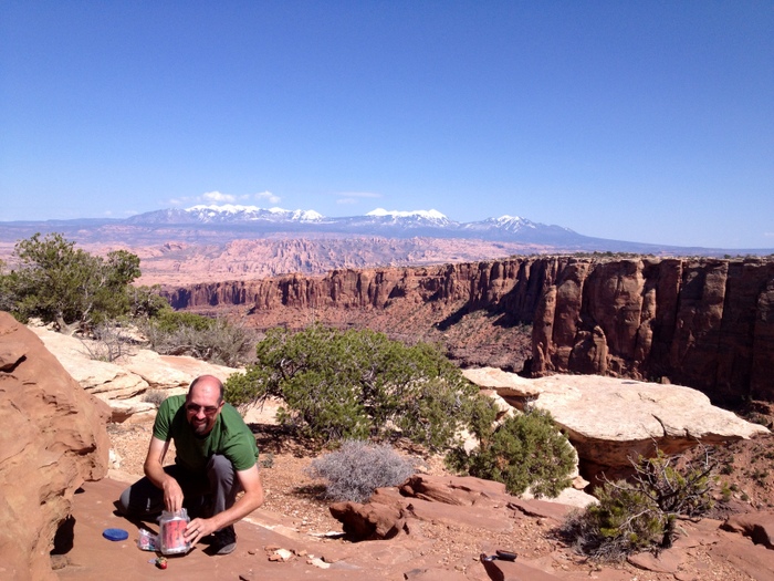
At the top of the canyon we drove along a flat mesa to the visitor center. A look at the park map showed there is really only one road you can travel around the mesa. From this road there are multiple spots to stop and look out on the canyons below. Since we had spent a while on the journey to the park, we decided on just two stops before heading back. Our first stop was at an overlook where we took out our chairs and had lunch with a view.
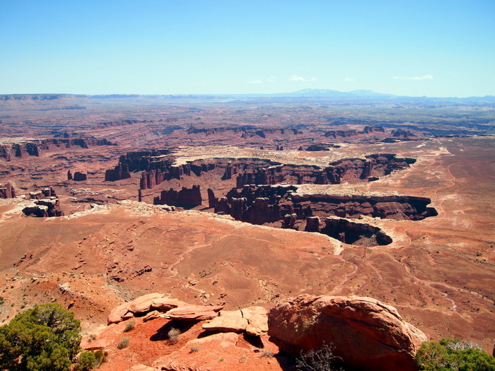
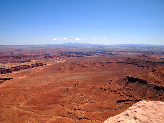
Next we moved on to the Grand View where a one-mile path runs along side the canyon providing awe-inspiring views.
The Islands in the Sky area of Canyonlands N.P. is a cool natural wonder, but not anywhere that you need to spend an extended amount of time to see what it has to offer. Truthfully, we had just as much fun getting to the park, as spending time in the park. For the drive back to town we decided to take yet another 4-wheel drive road. Long Canyon Rd. is a short dirt road that travels past Dead Horse State Park and winds its way down through the canyon. On the way we stopped for a little geocaching and a view.
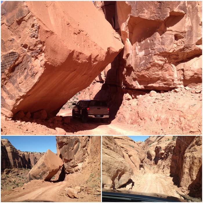
The best part of the road was when we came to this gigantic rock that had fallen across the road. As we approached it from a distance I had a brief moment where I wondered if we were too tall to drive beneath. As we got closer it became obvious that there was more than enough room. The road continued down from here before hooking up with the main rd. into Moab.
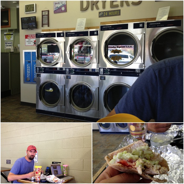
Our last day in Moab was spent running around town doing errands and stocking up for the next week or so in areas with little or no services. I bought enough food to last almost two weeks, and somehow managed to fit it all in our tiny cupboards and small RV fridge. We also made our second trip to the Moab laundromat where the machines are new, the building is clean, and the wifi is free. I brought along a lunch of leftover Chicken Gyros with homemade Tzatziki sauce. I think we were the envy of the entire laundromat.
This morning we headed out of town and onto our next adventure. We’ll be spending the next week or so in the south-east part of Utah where we plan to visit several different boondocking spots. Our first stop is at a national forest campground high in the mountains just south of Monticello. We’re currently at around 7,000′ in elevation right now, and it’s expected to get cold the next few days- 50s during the day and 30s at night. The campground is really, really nice though so we’ll probably stay a few days before moving on. Pictures coming soon.




6 comments
Nice roundup of your last week. Those petroglyphs you found were uber cool! Can’t wait to hear about your adventures down south.
Nina
Weren’t they cool? The best part is that we came upon them by accident :)
Great post on Moab. We will be in that area the middle of May. Really excited!
Enjoy! It’s a great area to visit. Tons to keep you busy.
There is so much going on in this post!!
Phin and the dirt naps. Of course Curtie loves those too – it’s the reason we didn’t give him a bath last week in LA. We figured the clean coat wouldn’t last.
That boondocking spot…we need specifics! GPS maybe?
http://goo.gl/maps/r5tSw
Just looking at it now and comparing it to the Motor Vehicle Use Map, that looks to be private property (though we saw no signs).
Further down the street appears to be several possible sites though.
Nina from WheelinIt turned us on to the Motor Vehicle Use Maps..
http://www.fs.usda.gov/Internet/FSE_DOCUMENTS/stelprdb5375670.pdf
The camphost here gave us the full paper version of Manti-La Sal Forest. Huge and has every single road on it. Definitely going to start stopping at NFS offices and collecting more.